#26 Weekly Remote Sensing and Geoscience news! 🛰️🌍
Landslides in São Paulo, Brazil (update), Landsat 9 TIRS Anomaly, new features for ESA&NASA altimetry portal, Scene From Above Podcast: new episode, ESA Biomass satellite in 2024, and more!
These are the topics of our #26 newsletter issue:
🛰 Landslides in São Paulo, Brazil
🛰 Landsat 9 Thermal Infrared Sensor Anomaly
🛰 ESA is hiring!
🛰 NASA Training: Crop Mapping using Synthetic Aperture Radar (SAR) and Optical Remote Sensing
🛰 2023 Global Space Conference on Climate Change
🛰 New features for ESA and NASA altimetry portal
🛰 ESA Biomass satellite will be launched in 2024
🛰 Scene From Above Podcast: new episode
🛰 Week's recommended reading
If you are not a subscriber, please, consider it. You are very welcome.
This is a free newsletter in order to make science more accessible to all of you.
Would you like to support me? You can easily buy me a coffee (or a book) at the bottom below. :)
If you can't do it, don't worry. You are always very welcome. 💚
I wish you a good read! :)
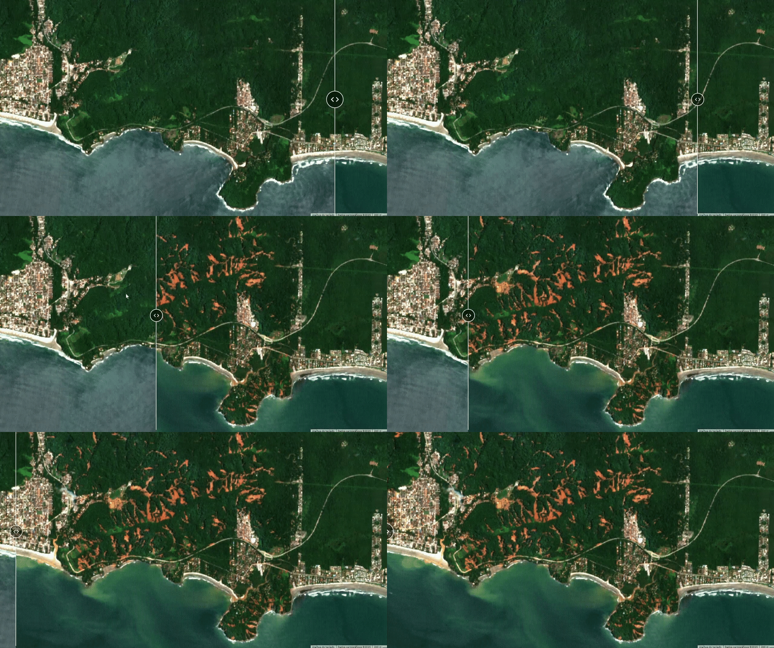
Landslides in São Paulo, Brazil
As mentioned in our last newsletter issue, 627mm of rain fell in 24 hours, twice the expected amount for the month.
📰 BBC News: São Paulo: Dozens killed as deadly storms hit Brazilian coast
The geographer Jéssia Uchôa updated her Google Earth Engine application in order to better identify the number of landslides and the result is impressive! Worth a look!


Landsat 9 Thermal Infrared Sensor Anomaly
🛰️ On the afternoon of February 27, 2023, the USGS/NASA Flight Operations Team (FOT) noticed dropped electrical currents in the Landsat 9 Thermal Infrared Sensor (TIRS).
🛰️ Landsat 9 Collection 2 Level-1 product processing was immediately paused to allow the FOT to investigate and determine the cause.
➡️ The Landsat 9 Operational Land Imager (OLI) sensor was not affected by this anomaly.
📰 USGS news: Recent Landsat 9 TIRS anomaly pauses processing of new Landsat 9 data


ESA is hiring!
There are a lot of opportunities in various fields such as:
🛰️ Engineering
🛰️ Science
🛰️ Business Services
...and more!
That's worth a look! Best of luck to you! 🍀


NASA Training: Crop Mapping using Synthetic Aperture Radar (SAR) and Optical Remote Sensing
By the end of this training attendees will be able to:
🛰️ Monitor crop growth with polarimetric time series SAR data from Sentinel-1
🛰️ Examine crop growth using a canopy structure dynamic model and time series of Sentinel-1 imagery
🛰️ Classify crop type using a time series of radar and optical imagery (Sentinel-1 & Sentinel-2)
Available in English: Crop Mapping using Synthetic Aperture Radar (SAR) and Optical Remote Sensing
Also available in Spanish // También en español: Mapeo de Cultivos Usando Radar de Apertura Sintética (SAR) y Teledetección Óptica


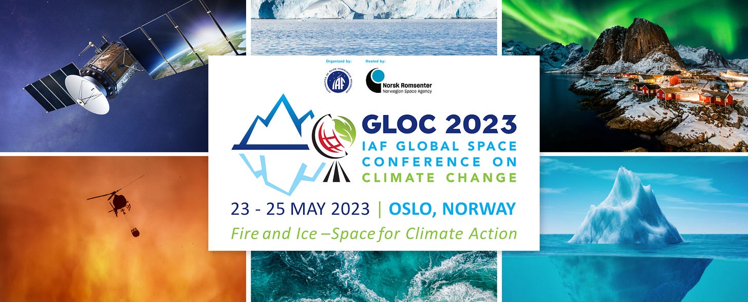
2023 Global Space Conference on Climate Change
GLOC 2023 will focus on the theme "Fire and Ice – Space for Climate Action" and will address various topics of interest in relation to space and climate change with a specific focus on:
🌍 Climate change impacts on the environment
🌍 Applications and services driven by climate change
🌍 Impacts of a changing climate on policy and law
🌍 Commercial opportunities created by a changing climate
🌍 Present and future international collaboration on space missions related to climate change
🌍 Social, communications, economic and cultural dimensions of environmental change
📅 23 - 25 May 2023
📍 Oslo, Norway
⚠️ Check out the IAF GLOC 2023 Students Grant Programme: The IAF GLOC 2023 Students Grant Programme offers up to 10 grants to participate in the IAF Global Space Conference on Climate Change – GLOC 2023
New features for ESA and NASA altimetry portal
Users can now:
❄️ Find known locations fast
❄️ View Sentinel imagery coincident with results
❄️ Latitude/longitude helper lines and polar stereographic coordinates
❄️ CryoVEx GIS previews
❄️ New NASA IceBridge sea ice quick look dataset
📰 ESA news: Stunning new features for ESA and NASA altimetry portal cs2eo.org

ESA Biomass satellite will be launched in 2024
🛰️ After months of successful testing, ESA announced that this new earth explorer mission is a few steps closer to its mission.
🌳 The mission’s ‘P-band’ long wavelength, synthetic aperture radar will deliver completely new information on global forest biomass. This not only includes the trunk of the tree but also its bark and branches, says ESA.
🛰️ The Biomass satellite will be launched atop a Vega rocket from Europe’s Kourou Spaceport in 2024.
📰 Forbes: ESA Biomass Satellite Set To Map Earth’s Essential Old Growth Forests


Scene From Above Podcast: new episode
🎧 Looking for something to listen this weekend? Well... I have a suggestion! :)
🎙️ This episode features Sabrina Szeto, who is a geospatial consultant who empowers organizations to use geospatial data and technology.
🎙️ She is a Google Developer Expert for Earth Engine. Sabrina has a Masters in Forestry from Yale University and a BA in Anthropology from Princeton University.
🎙️ She also is the co-founder and former Director of Women+ in Geospatial.
...and, of course, the news segment with me. :)


Week's recommended reading
Are you interested in analyzing land use/land cover changes using Artificial Neural Network algorithm? So, this paper can be helpful to you! :)
In this paper, the potential of the hyperspectral dataset Hyperion EO-1 is evaluated in estimating LULC multitemporal changes using a straightforward artificial neural network-based post-classification comparison change detection approach.
📰 You can check all my recommended papers at the bottom below:
Thanks for reading! See you next week!
Don't forget to like it and comment.
I appreciate it and I love to hear from you.
With love,
— Rafaela Tiengo


