
#25 Weekly Remote Sensing and Geoscience news! 🛰️🌍
Flooding and landslides in São Paulo (Brazil), Sentinel-2 Land Cover Explorer, ESA Space Weather Training Course, GATHERS Hackathon: Analysis of laser scanning point clouds (LiDAR), and more.

These are the topics of our #25 newsletter issue:
🛰 Flooding and landslides in São Paulo, Brazil
🛰 A new web-based mapping application: Sentinel-2 Land Cover Explorer (10m)
🛰 ESA Academy’s: Space Weather Training Course
🛰 GATHERS Hackathon: Analysis of laser scanning point clouds (LiDAR)
🛰 EarthScope Student Careers Internship Program is now open
🛰 ESA's wind mission helps to investigate the nature of volcanic plumes
🛰 New section on our newsletter: Recommended Readings
If you are not a subscriber, please, consider it. You are very welcome.
Ps.: we are more than 1,000 subscribers now! Thank you so much for supporting me and being here. 💚
This is a free newsletter in order to make science more accessible to all of you.
Would you like to support me? You can easily buy me a coffee (or a book) at the bottom below. :)
If you can't do it, don't worry. You are always very welcome. 💚
I wish you a good read! :)
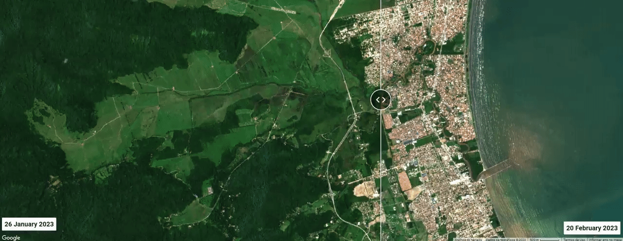
Flooding and landslides in São Paulo, Brazil
In the coastal town of São Sebastião (São Paulo), 627mm of rain fell in 24 hours, twice the expected amount for the month.
Some 50 houses had collapsed and were washed away and at least 40 people have been killed.
📰 BBC News: São Paulo: Dozens killed as deadly storms hit Brazilian coast

A new web-based mapping application: Sentinel-2 Land Cover Explorer (10m)
Generating this information is foundational, and Sentinel-2 Land Cover Explorer will be invaluable for helping decision-makers unlock critical insights about land use, particularly as sustainability becomes a pressing global concern.
On this new web-based mapping information is possible to access:
🗺️ Timely Maps
🗺️ Change Analysis
🗺️ Visual Change Analysis
🗺️ Statistical Change Analysis
🗺️ Visual Validation
🗺️ Offline Use
🗺️ Save and Share Your Views
...and more!
📰 ArcGIS Blog: Global Land Cover Revealed


ESA Academy’s: Space Weather Training Course
The training course intends to provide students with an overview and introduction to the space weather domain from a range of perspectives. This will include scientific and technological fundamentals, space weather monitoring, forecasting, modelling, and understanding of its technological impacts along with an outlook toward the domain’s evolution in the future.
📅 8 to 12 May 2023
📍 ESEC-Galaxia, Belgium
✍🏾 Free
⚠️ The deadline for applications is 13 March 2023 23:59 CEST.
Selected students will be requested to attend the entire 5-day training course at ESEC-Galaxia. They will be sponsored by ESA to cover accommodation and meals, as well as up to 300 Euros for travelling to Belgium.
I highly recommend the ESA Academy’s courses. In December 2022 I had the opportunity to attend the "Earth Observation Remote Sensing Workshop" at the same place (ESEC-Galaxia, Belgium) and it was a really nice experience and a very enriching week with a lot of shared knowledge.
📰 Here you can check my LinkedIn post about how was the event.
— Rafaela Tiengo


GATHERS Hackathon: Analysis of laser scanning point clouds (LiDAR)
👩🏾💻 The event is specifically open for creative and technical approaches, and groups are invited to concentrate on either creative design, technological development and implementation, or even a combination of both.
👩🏾💻 The provided point clouds include close and far range datasets, with point densities ranging from 10-1000 points/m2 covering natural, anthropologically formed, and built-up areas and multi-temporal datasets, including data with additional attributes (color, classification, etc).
👩🏾💻 A JupyterLab environment serves as programming platform (IPython notebooks, notebooks in other programming languages such as C++).
📅 13 and 14 April 2023
📍 Vienna, Austria
✍🏾 Free
I highly recommend the GATHERS' events. In September 2022 I had the opportunity to attend the Summer School in Poland and I learned a lot from them about Interferometric Synthetic Aperture Radar (SAR), Light Detection and Ranging (LiDAR), Global Navigation Satellite System (GNSS), and more.
📰 Here you can check my LinkedIn post about how was the event.
📰 Here you can check my thread on Twitter with daily details of the event.
— Rafaela Tiengo


EarthScope Student Careers Internship Program is now open!
Positions for 2023:
👩🏾💻 Data Science Intern
👩🏾💻 OpenTopography Data Science Intern
👩🏾💻 Field Engineer Intern
👩🏾💻 Science Communication Intern
👩🏾💻 Education and Student Resources Intern
Thanks to Juvair Hossan who sent this opportunity to me in order to share it with you all. :)


ESA's wind mission helps to investigate the nature of volcanic plumes
🌋 Scientists used these data – along with observations from Copernicus Sentinel-5P to reveal a swirling stratospheric mass of sulfur dioxide and other volcanic emissions that circled the globe three times and ascended to an altitude of some 27 km through the radiative heating of ash.
🌋 The finds have important implications for the study of the transport of volcanic emissions and their stratospheric residence time, as well as the atmospheric radiation balance.
📰 Full scientific report: Unexpected self-lofting and dynamical confinement of volcanic plumes: the Raikoke 2019 case

New section on our newsletter: Recommended Readings
💡 I decided to create a new section in our newsletter: the Recommended Readings.
In this section, I will bring to you papers that I’ve read and really recommend about Remote Sensing and Geoscience.
For the first paper recommendation, I will be a little bit self-centered (😇) and I will recommend you a recently published paper in which I am a co-author:
This paper used the ASTER sensor to observe changes in the near-infrared signals (15 m spatial resolution) six months after an anomaly emerged. In contrast, the thermal signal (90 m spatial resolution) only changed its threshold value one and a half years after the anomaly was recognized.
The results show that wavelength and spatial resolution can influence the response time in detecting changes in a system. This paper reiterates the importance of using thermal imaging and high spatial resolution images to monitor and map thermal anomalies in hydrothermal systems such as those found in the Azores.
A big congrats to Jéssica Uchôa for her first first-author paper. 🎉
📰 You can check all the recommended papers at the bottom below:
Thanks for reading! See you next week!
Don't forget to like it and comment.
I appreciate it and I love to hear from you.
With love,
— Rafaela Tiengo