


EO NEWS 60: Fire on Madeira Island (Portugal) - Application to identify buildings in areas affected by fires
Juice snaps Moon en route to Earth.

If you are not a subscriber, please, consider it. You are very welcome.
Se você não é inscrito (a), por favor, considere se inscrever. Você é muito bem-vindo (a).
📰 Latest news // Últimas notícias
👩🏾💻 New features in geemap. Novos recursos no geemap.
🌕 Juice snaps Moon en route to Earth. Juice fotografa a Lua a caminho da Terra.
🔥 Fire on Madeira Island (Portugal) - Application to identify buildings in areas affected by fires. Incêndio na Ilha da Madeira (Portugal) - Aplicação para identificação de edifícios em áreas afetadas pelos fogos.
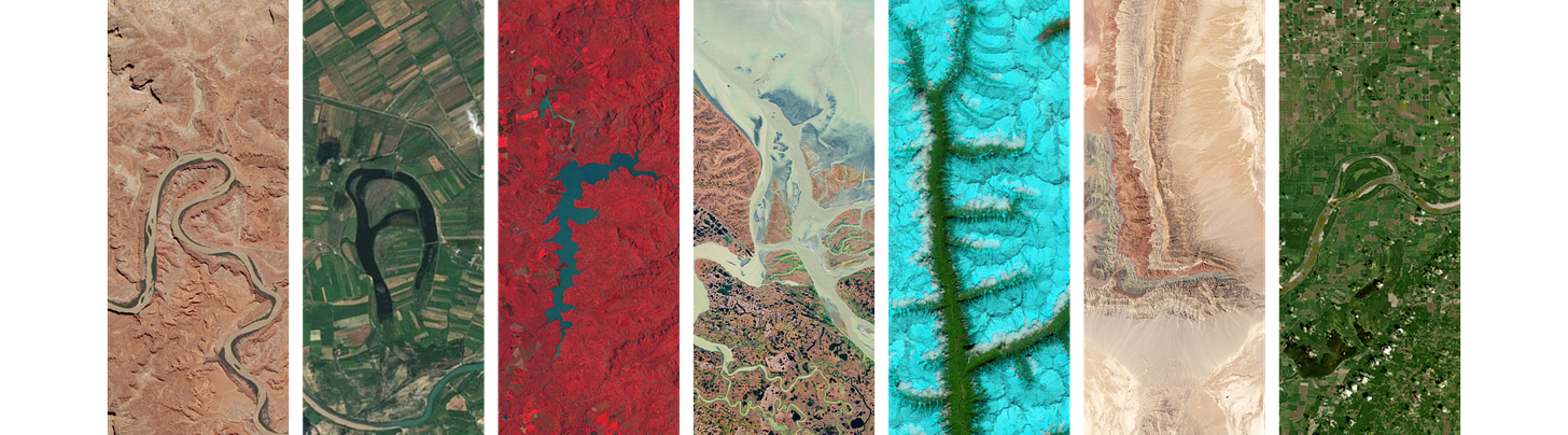
🛰️ Your name with images from the Landsat missions. Have fun! Seu nome com imagens das missões Landsat. Divirta-se!

This is a free newsletter in order to make science more accessible to all of you. Would you like to support me? You can easily do this:
If you can't do it, don't worry. You are always very welcome. 💚
💼 Job offers // Oportunidades de emprego
Geographic Information System Developer (Cairo, Egypt)
Project Officer - Module and soil carbon indicators (Ispra, Italy)
Satellite Technical Program Manager (Mountain View, CA)
Senior Geospatial Manager – Ecosystem & Carbon Management (Bangkok, Thailand)
Senior Geospatial Manager - Air Quality and Health (Bangkok, Thailand)
GIS Specialist (Nairobi, Kenya)
Geographic Information Systems Engineer (Lisbon, Portugal)
GIS analyst – Land Management (St Helena/Falkland Islands)
GIS officer, UAV pilot, and database manager (Falkland Islands)
Estágio em Geoprocessamento (Belo Horizonte, Brasil)
Analista em Geoprocessamento (Paraná, Brasil)
ArcGIS - Senior GIS Desktop Developer (Bengaluru, India)
GIS Analyst - Information Technology (Sofia, Bulgaria)
GIS Technician (Arizona, USA)
GIS Specialist (Brisbane, Australia)
GIS Intern: Support in the production of GIS maps for senior leadership (New York, USA)
PhD on statistical theory for deep learning based image classification (Overijssel, Netherlands)
Geographic Information System Officer (Kyiv, Ukraine)
Analista de Geoprocessamento (Paraná, Brasil)
Analista Banco de Dados e Geoprocessamento (Maranhão, Brasil)
Analista de Meio Ambiente Pleno - Geoprocessamento (Nova Lima, Brasil)
GIS Technician (California, USA)
Coordinator - GIS Analytics (Cape Town, South Africa)
Head of Earth Observation (Rome, Italy)
Ph.D. Candidate in Geography with focus on climate resilience (Trondheim, Norway)
Estágio em Geoprocessamento (Belo Horizonte, Brasil)
Analista de Edição Cartográfica (Santa Catarina, Brasil)
Agroforestry Specialist (Rome, Italy)
GIS Expert (Sindh, Pakistan)
GIS Cadastral Mapping Technician (Overland Park, KS, USA)
Geographic Information Systems Manager I (California, USA)
Cartographic Technician (California, USA)
Geospatial Engineer (Wisconsin, USA)
30 PhD and Postdoc Funded Positions in Climate Science at two Universities (Hamburg and Bremen, Germany)
Programme Associate - GIS & Remote Sensing (Damascus, Syria)
Assistente de Geoprocessamento I (São Paulo, Brasil)
Geospatial Data Analyst (New York, USA)
Estágio em Geoprocessamento (Remoto, Brasil)
Analista Pleno (Geógrafo) - Vaga Extensiva para Pessoas com Deficiência (Belo Horizonte, Brasil)
GIS Specialist (Barcelona, Spain)
GIS Specialist (Lusaka, Zambia)
Analista de Geoprocessamento (Natal, Brasil)
Expert – Greenhouse gas emissions and carbon removals (Copenhagen, Denmark)
Launch Manager (Helsinki, Finland)
Analista De Sistemas De Informações Geográficas (Belo Horizonte, Brasil)
GIS Analyst (San Salvador, El Salvador)
GIS and Lidar Technician (Alberta, Canada)
5 PhD and Postdoc positions in AI for atmospheric modelling and satellite remote sensing (TU Delft, The Netherlands; Bern, Switzerland)
Biodiversity Data Coordinator (New Haven, USA)
Remote Sensing Scientist (New Haven, USA)
Geospatial Lab Manager (New Haven, USA)
PhD Researcher: Advancing Forest Inventories in Small EU Countries Using Field Data and Multi-Source Remote Sensing (Wageningen, The Netherlands)
📆 Upcoming events // Próximos eventos
Cryo2ice Symposium 2024 (Reykjavik, Iceland)
Workshop - Very High-resolution Radar & Optical Data Assessment 2024 (Frascati, Italy)
Workshop - URBIS24 (Frascati, Italy)
Workshop - EU Coastal Use Cases (Online)
10th Anniversary of ESA Space Solutions Portugal (Coimbra, Portugal)
Industry Space Days (Noordwijk, The Netherlands)
International Conference on Advanced Remote Sensing 2025 (Barcelona, Spain)
EUMETSAT Meteorological Satellite Conference 2024 (Würzburg, Germany)
ESRI Portugal Education Summit 2024 (Lisbon, Portugal)
Formação sobre desastres naturais e a importância dos satélites (Em Português, Online)
Training - Atmospheric Composition (Kjeller, Norway)
Earth Observation for Climate - Climate Week (New York, USA)
European Climate Change Adaptation Conference 2025 (Rimini, Italy)
GeoAI Challenge (Online)
EU Climate Pact's satellite event: From Risk to Resilience (Online)
Webinar - Fine-Resolution Measurement of Soil and Vegetation Moisture using InSAR Closure Phase (Online)
Talk - Biodiversity Modelling Under Climate Change: From Individual Species to Communities (Évora, Portugal; Online)
Webinar - Science and Solutions for a Clean, Healthy, & Resilient Ocean (Online)
SpaceOps 2025 - Toward Space Sustainability (Montréal, Canada)
7th ACM SIGSPATIAL International Workshop on AI for Geographic Knowledge Discovery (Georgia, USA)
Webinar - ESA’s Blue Economy project: Marine Renewable Energies (Online)
🤳 My content // Meu conteúdo
My last paper! It's a systematic literature review based on remote sensing approaches for land use/land cover change in coastal areas and oceanic islands. Meu último artigo! É uma revisão sistemática de literatura baseada em abordagens de sensoriamento remoto para mudança de uso/cobertura da terra em áreas costeiras e ilhas oceânicas.
Transform your field data collection with QField for free. Transforme sua coleta de dados de campo com QField gratuitamente.
10 powerful QGIS plugins to elevate your geospatial projects! 10 plugins QGIS de hashtag poderosos para elevar seus projetos geoespaciais.
5 materials to get started with QGIS. 5 materiais para começar a usar o QGIS.
10 recent papers about fire and wildfires. 10 artigos recentes sobre incêndios e incêndios florestais.
This is a free newsletter in order to make science more accessible to all of you. Would you like to support me? You can easily do this:
If you can't do it, don't worry. You are always very welcome. 💚
🦾 Thanks for reading! Don't forget to like it and comment if it was helpful. I appreciate it and I love to hear from you.
Obrigado por ler! Não esqueça de curtir e comentar se foi útil. Eu adoro saber a opinião de vocês. :)
If you are not a subscriber, please, consider it. You are very welcome.
Se você não é inscrito (a), por favor, considere se inscrever. Você é muito bem-vindo (a).