


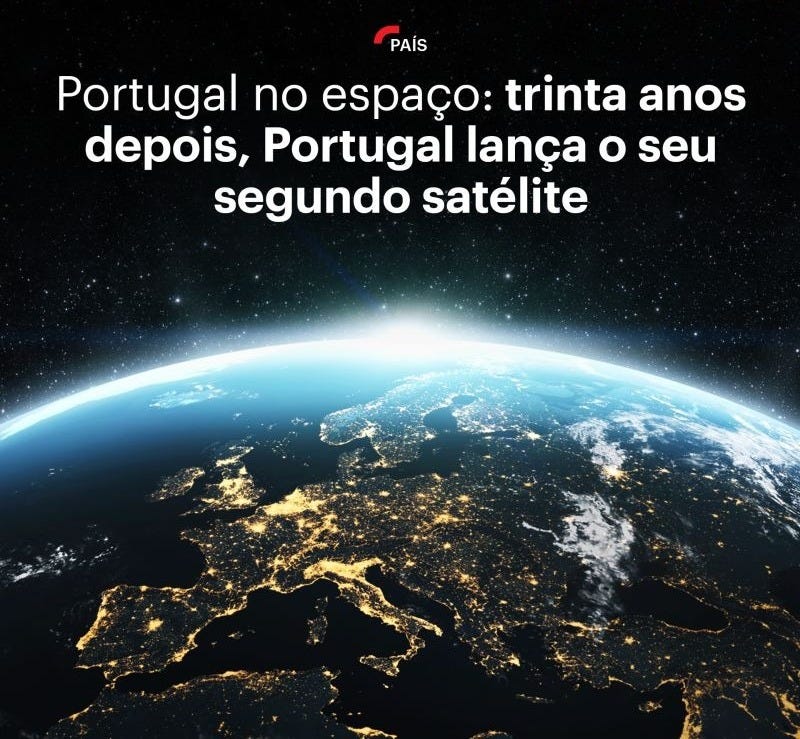
EO NEWS #52: AEROS MH-1 — the second Portuguese satellite into orbit
Iceye launches radar satellite service to monitor the high seas.

“Believe you can and you're halfway there.” // “Acredite que você pode e você já está a meio caminho”. — Theodore Roosevelt

If you are not a subscriber, please, consider it. You are very welcome.
Se você não é inscrito (a), por favor, considere se inscrever. Você é muito bem-vindo (a).
📰 Latest news // Últimas notícias
🚀 AEROS MH-1 — the second Portuguese satellite into orbit. The MH-1, called AEROS, a pioneering satellite in the Portuguese space industry and the only one in this segment, has already been successfully placed in orbit and will allow us to exclusively study the sea and the species of the 5th largest geological platform on the planet: the Portuguese, and the gathering of data will be done from the teleport in Santa Maria island, Azores.
—
O MH-1, batizado de AEROS, satélite pioneiro na indústria espacial portuguesa e único neste segmento, foi já colocado em órbita com sucesso e vai permitir estudar o mar e as espécies da 5ª maior plataforma geológica do planeta: a portuguesa, e a recolha de dados será feita a partir do teleporto na Ilha de Santa Maria, nos Açores.
🛰️ Iceye launches radar satellite service to monitor the high seas. Iceye lança serviço de radar por satélite para monitorar alto mar.
🚀 SpaceX adds tests to next Starship flight. SpaceX adiciona testes ao próximo voo da Starship.
🌍 Magnetic magic: 10 reasons to be excited about Swarm. Magia magnética: 10 razões para estar entusiasmado com o Swarm.
🗺️ GEOSAT-2 Spain Coverage 2022 collection open to users. Coleção GEOSAT-2: Cobertura de 2022 da Espanha disponível aos usuários.
🛰️ Go-to guide to Third Party Mission data offering. Guia prático para a oferta de dados da Third Party Mission.
💰 Get an inside look at what spatial thinking brings to some of the world’s biggest brands. Dê uma olhada no que o pensamento espacial traz para algumas das maiores marcas do mundo.
💼 Job offers // Oportunidades de emprego
Chief Operating Officer (The Netherlands)
Associate Professor in Marine Geoscience (Bergen, Norway)
Remote Sensing Intern (Luxembourg)
Project Officer – GIS Specialist (Petten, The Netherlands)
Thermal Remote Sensing Scientist (Whiteknights Reading, UK)
Satellite Data Processing Software Engineer (Brussels, Belgium)
Doctoral Researcher in Land Use Planning (Aalto University, Finland)
📆 Upcoming events // Próximos eventos
European Space Weather Week (Coimbra, Portugal)
ECMMWF Code for Earth 2024 (Online)
Women in Tech Porto Summit (Porto, Portugal)
AIR Centre & UFRJ - Workshop on harnessing space technological applications for SDGs (Rio de Janeiro, Brazil)
African Computer Vision Summer School (Nairobi, Kenya)
2024 Ocean Decade Conference (Barcelona, Spain)
Conference: Remote Sensing for Agriculture, Ecosystems, and Hydrology (Edinburgh, United Kingdom)
Spatial Information Science Symposium (Perth, Australia)
ESA 3rd MedCyclones Workshop & Training School (Rome, Italy)
Marine Robotics Summer School (Faial Island, Azores, Portugal)
SPAICE: AI in and for Space (ESA ECSAT, UK)
Summer School Alpbach 2024 (Alpbach/Tyrol, Austria)
🤳 My content // Meu conteúdo
🌊 5 NASA ARSET resources for ocean and coastal mapping. // 5 recursos NASA ARSET para mapeamento oceânico e costeiro.
🌧️ 5 essential NASA ARSET resources for your expertise in Remote Sensing for flood mapping. // 5 recursos NASA ARSET essenciais para sua experiência em sensoriamento remoto para mapeamento de inundações.
🛰️ Take the first step on your Radar Data learning journey today! Check out 5 top-notch resources available for FREE! // Dê o primeiro passo em sua jornada de aprendizado sobre dados de radar hoje mesmo! Confira 5 recursos de primeira linha disponíveis GRATUITAMENTE!
🔥 Here are 5 crucial NASA ARSET available resources to fuel your journey in fire mapping. // Aqui estão 5 recursos NASA ARSET cruciais para a sua jornada no mapeamento de incêndios.
🗺️ 5 NASA ARSET materials for land cover mapping. // 5 materiais NASA ARSET para mapeamento da cobertura do solo.
🌱 5 materials that will help you to study and understand Vegetation Indices through Remote Sensing. // 5 materiais que vão te ajudar a estudar e entender os Índices de Vegetação através do Sensoriamento Remoto.
🦾 Thanks for reading! Don't forget to like it and comment if it was helpful. I appreciate it and I love to hear from you. // Obrigado por ler! Não esqueça de curtir e comentar se foi útil. Eu adoro saber a opinião de vocês. :)
📲 Follow me // Me siga
Twitter • LinkedIn • GitHub • SFA Podcast
If you are not a subscriber, please, consider it. You are very welcome.
Se você não é inscrito (a), por favor, considere se inscrever. Você é muito bem-vindo (a).
This was definitely the best issue yet. Very rich with info and resources. Thank you!
Thanks for sharing!