#14 Weekly Remote Sensing and Geoscience news! 🛰️🌍
📢 The Remote Sensing and Geoscience news in 5 minutes.
The new season of the Scene From Above podcast is out!
...and I am on this! 🎉
Happy to announce the new season of the Scene From Above podcast which I'm the news correspondent! 🎙️📰🛰️
The Scene From Above Podcast was hosted by Alastair (@ajggeoger) and Andrew (@map_andrew) with over 30K listens during 12 seasons. 🤯 Now, season 13 will be hosted by the Ladies of Landsat and Sisters of SAR. 🎉
In this first episode (hosted by Morgan Crowley and Gopika Suresh, we tell you about us, our organizations & our missions & visions. You will get to know our contributors and collaborators a little better, learn about their lives, careers and journeys in the field of Remote Sensing and hear about the challenges they experienced.
You will also hear from me about the latest in Remote Sensing and GIS. 👩🏾🚀🛰️🌍
Listen on:
🎧 PodBean
🎧 Spotify
I hope you all enjoy it! 💚
Call for papers: IEEE Journal - Quantum Computing for Earth Observation
This special issue aims to introduce this extraordinary field to the GRSS community, present the current state-of-the-art in quantum technologies, identify challenges and opportunities, and engage the quantum community for EO in the long term.
📆 December 31, 2022
Special Issue on ''Quantum Computing for Earth Observation'' - GRSS-IEEE — www.grss-ieee.org
Workshop: Remote Sensing Data Management Technologies in GeoScience
The aims are to promote the effective uses of appropriate data management technologies and to increase the value of Remote Sensing data.
The focus will be on bringing together a research community to review the state of the art in data management tools and understand the application requirements.
Topics may include, but are not limited to:
🛰️ Spatio-temporal database solutions for Big Remote Sensing Data
🛰️ Graph databases, knowledge graph, graph visualization, web semantics tools/technologies for managing and discovering data and metadata in Remote Sensing
🛰️ Novel database solutions for Analysis-Ready Data (ARD)
🛰️ Using Big Data management and analysis tools for Remote Sensing data management and analysis
🛰️ (Near-)Real-time intelligence from Remote Sensing platforms
📅 December 2nd
📍 Paris, France (hybrid/virtual)
IEEE GRSS workshop on Remote Sensing Data Management Technologies in GeoScience 2022 — www.grss-ieee.org
Applications for ESA internships are open!
Are you ready to ignite your potential? The next round of internship opportunities at ESA is out remaining open for one month.
Opportunities are available in engineering, science, IT, natural/social sciences, business and administration services. Internship placements are between three and six months’ long.
Check it! 👇🏾
ESA - Applications for ESA internships open this November — www.esa.int
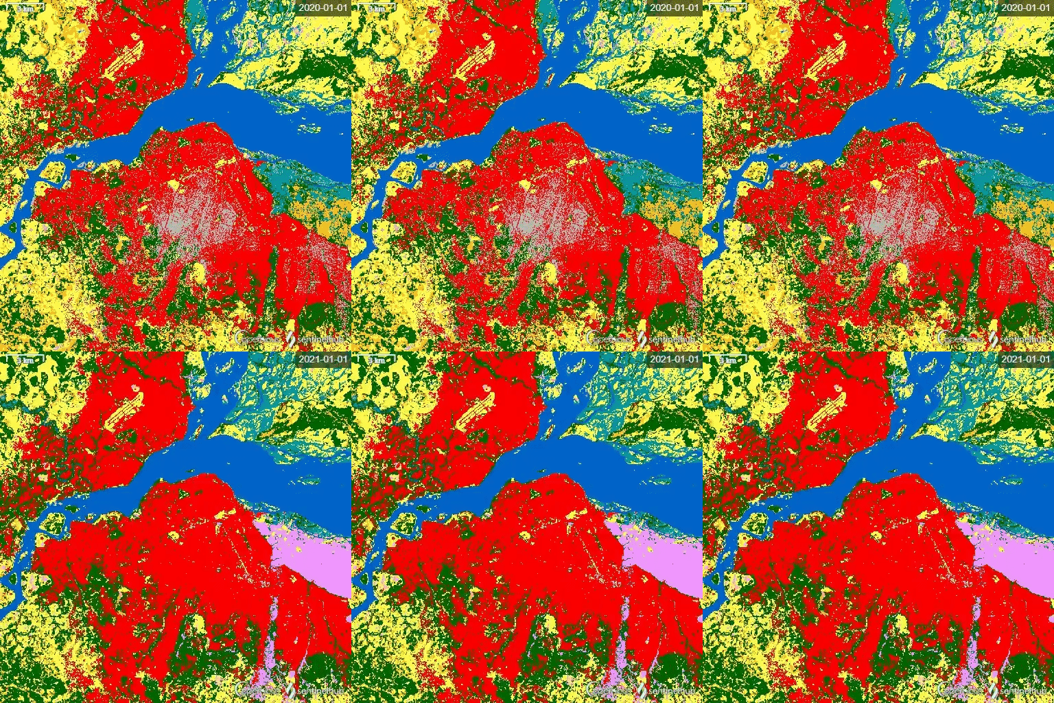
ESA World Cover 2020 and 2021 on SentinelHub
🛰️ The ESA WorldCover is a global land cover map with 11 different land cover classes produced at 10m resolution based on the combination of both Sentinel-1 and Sentinel-2 data.
👩🏾💻 You can check it on Sentinel Hub EO browser:


The most outstanding new features of QGIS 3.28 Firenze
👩🏾💻 In this blog post (in Spanish) you will know the most interesting changes and news on this new version of #Firenze.
Las novedades más destacadas de QGIS 3.28 Firenze - MappingGIS — mappinggis.com
Pi School: full-grant fellowships available in Earth Observation
Pi School is looking for candidate fellows for the Pi School of AI 8-week programme starting on November 21st 2022, who are already familiar with the Earth Observation (EO) context.
➡️ START DATE: November 21st, 2022
➡️ DURATION: 8 weeks full-time
➡️ LOCATION: 6 weeks remotely + 2 weeks in Rome
➡️ FEES: The programme fees of 12,500 € are fully covered by the available grants.
Earth Observation: full-grant fellowships available — picampus-school.com


